
Digital Map Artist Statement: My Prague Experience (2.0)
Click link to view project
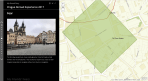
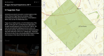
Stills of project:


by Nicole Cuneo
My initial map design stemmed from a personal geography map. One thing I would like to note in the beginning is that this project is building on an original project, titled “My Personal Geography Map.” The reason why I find this distinction so important is because I have received feedback on my original map, the ideas are a collaborative effort. Additionally, if one is comparing the two maps created, they are intended for different audiences. Initially, my map was a reflection of my abroad experience; I wanted it to be genuine and allow myself to look back at the map in a personal journal-type manner. The map was exactly what the title stated it to be, a personal geography.
I found the idea of this current map when I was first proposed the “Personal Maps” assignment. I knew I wanted to map Prague. Initially, my map design resembled a deep map as described by Harris (3). The way I felt, how my space did not accurately depict the “standard” time and space, and my different attachment/experience with monuments were all of the concepts I wanted to capture. However, as my knowledge of map-making and types of maps increased, I have recently become cognizant of grassroots mapping (Diehl). Grassroots mapping is mapping as a collaborative effort. This kind of mapping consists of input from those who relate to the map. This input can derive from living within the area the map covers, experiencing what the map is portraying, providing supplementary data, incorporating photographs taken by others, and so forth.
Grassroots mapping particularly appealed to me when looking at my experience abroad. While I definitely had an independent, personal experience, a lot of my insights were related to the group. There are memories I have alone but, also, memories that I share. The accumulation of these experiences is the most accurate portrayal of my experience abroad, despite all of these events not being simply “personal.”
For this map, I decided to incorporate as much information as possible. While a true grassroots map would be the most inclusive of all participants, it would still neglect responses of those who did not understand or would not try to understand the software ARCGis. It would also potentially incorporate input from people I did not want to incorporate, for various reasons. Additionally, this was my own project, and I wanted authority to make it look the way I wanted it to be portrayed. Although this shows a clear bias, the bias is mine, and that is exactly what I wanted. I wanted to convey the collaborative experience abroad, told through my own eyes. I believe this is how my impressions should be most accurately displayed.
One of the most important lessons I have learned about grassroots mapping is that the way you recruit the data is critical. I conducted a few phone interviews, in-person interviews, conversations, and surveys. The survey style left the least amount of information out. There was more time to think, construct answers, and eventually look over answers before submitting the information. I think this content comes with a bias that cannot be written off. It is one thing to give an on-the-spot answer and another one to spend time constructing it. These constructions are just that–constructions of memories. But this approach allows for editing, looking at pictures, going through old notes, old Instagram posts, and include other ways to be persuaded by factors other than just memory.
In light of this, I decided to record a video of three of my abroad roommates. This interview was conducted on the spot, with no discussion of the topics, questions or anything that could give any of the answers away. This interview was far more comical and demonstrated a huge problem in recollection: People forget. Multiple times in the video, the person on camera would ask me, “What was that place called again?” and start listing a bunch of characteristics. In addition, I allowed my roommates to watch the video back (once they knew it could not be edited, redone, or deleted), and frequently they said, “How did I forget that?” or, “What’s wrong with me? I should have said . . .,” followed by a place they constantly visited.
While I understand there are clear gaps of information in the video, I think that those pieces of information are fulfilled by the data presented in the paragraph prior. In addition, what the paragraph prior lacks this video possesses. There are way more common trends, and the things that stood out are all the same. I wish I could have asked these questions closer to our abroad experience and compared the answers then and now.
While grassrooting clearly provides all different data inputs, it also provides me with things that I neglected to remember. For example, when asking people about their fears, I remembered a huge fear of mine own which came on the first Wednesday of every month. On the first Wednesday, Prague tested their siren system. We were unaware that something like this could happen, and we also did not even remotely speak the language. Hearing the siren system for the first time put me and my roommate in a complete sprint as we ducted for shelter. This fear eventually turned into joy–it was a reminder about how scared I was, and how funny I must have looked panicking throughout the city, preparing myself for some catastrophe. Because of this, the idea is masked by my joy, and I forgot this was classified originally as a fear. Hearing inputs from others helped trigger a personal memory within myself, something I would not have been able to do on my own.
Adding multimodal components (other than pictures) to my map was a huge step in achieving my goal of accurately portraying my experience abroad. I put a lot of pictures in my first map. However, I believe, if a picture speaks 100 words, a video must then speak an infinite amount. The video of my walk to class with the sun setting a a background far surpasses the beauty of my pictures. The video of the sounds of the siren encompasses so many features that I could not describe: The actual language, the accent, the accompanying siren noises, the volume and commentary from other civilians (located in the YouTube link). As previously discussed, the video provided a new source of data from my volunteers. This source of data supported the strongest trends that came from our combined experience in a foreign country.
Another critical reason why I wanted to identify a distinction between my personal geography map and this assignment is the inclusion of a tutorial video. In the first map, I did not have one as I wanted those to have viewed the map to be as confused as me. I wanted the viewers to have to figure out the orientation by jumping from map to map and then eventually see the full mental map view the same way I did. I wanted the viewers to have an experience as similar and emotionally accurate as the one I had. However, the assignment’s viewing platform changed. Since I am publishing this map to a real journal publication (“real” as defined by more legitimate than my own twitter account), I wanted to make sure the public understood exactly what I was trying to convey (via format) without having to do any leg work. Additionally, not everyone understands spatial awareness and spatial orientation like the members of my class do. Something that we discussed in class is how the physical world may not be truthful to all maps. While atlas may have the most accurate mapping of space/geography/location, these boundaries are not universal and may not be truthful throughout. Bodenhamer argues, “Our sense of space and place has become more complex and problematic, but in the process is has assumed a more interesting and active role in how we understand history and culture” (11). This is a concept that must be understood (or at least talked about) in order to grasp any part of my map formatting.
Something that I didn’t resonate with prior to making this multimodal map is to see space as an event. Atkin states, “If we consider spaces as events in the sense that they are an assemblage of previously unrelated forces rather than a thing, then it changes the way we think about spatial politics” (112). This directly applies to my map now, more so than my personal geography map. While I played around with time and space, I kept one thing constant: me. I was the only person thinking about these maps; I spent time editing it, and I spent the time recalling. I didn’t get diverse opinions, which secondarily impacted me. No one was able to quiz me on the spot; no one was able to test my knowledge. I have a dynamic version of spatial awareness, and that my events are spatial.
All in all, I am so grateful to have had the opportunity to re-look at my Prague personal map. I think this multimodal version of Prague achieved my goal of explaining my experience abroad. It has a grassroots nature that incorporates different viewpoints, stories, and preferences. However, all impressions are edited by me, creating a bias that I wanted displayed. I want to show other people’s experiences but do so through my own eyes and include, as well, how I was affected.
Works Cited
Aitken, Stuart C. “Quelling Imperious Urges…” Deep Maps and Spatial Narratives, edited by David J . Bodenhamer, John Corrigan, Trevor M. Harris, Indiana UP, 2015, pp. 102-33.
Bodenhamer, David J. “Narrating Space and Place.” Deep Maps and Spatial Narratives, edited by David J. Bodenhamer, John Corrigan, Trevor M. Harris, Indiana UP, 2015, pp. 7-27.
Diehl, Amy, et al. “Grassroots: Supporting the knowledge work of everyday life.” Technical Communication Quarterly, vol. 17, no. 4, 2008, pp. 413-34.
Harris, Trevor M. “Deep Geography-Deep Mapping: Spatial Storytelling and a Sense of Place.”Deep Maps and Spatial Narratives, edited by David J. Bodenhamer, John Corrigan,Trevor M. Harris, Indiana UP, 2015, pp. 28-53.
—
Nicole Cuneo is a graduate of University of Michigan, where she studied cognition and language. In her free time, Nicole took a cartography class where she explored different forms of expression.

You must be logged in to post a comment.